March 2016 Total Solar Eclipse
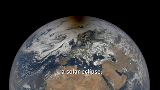
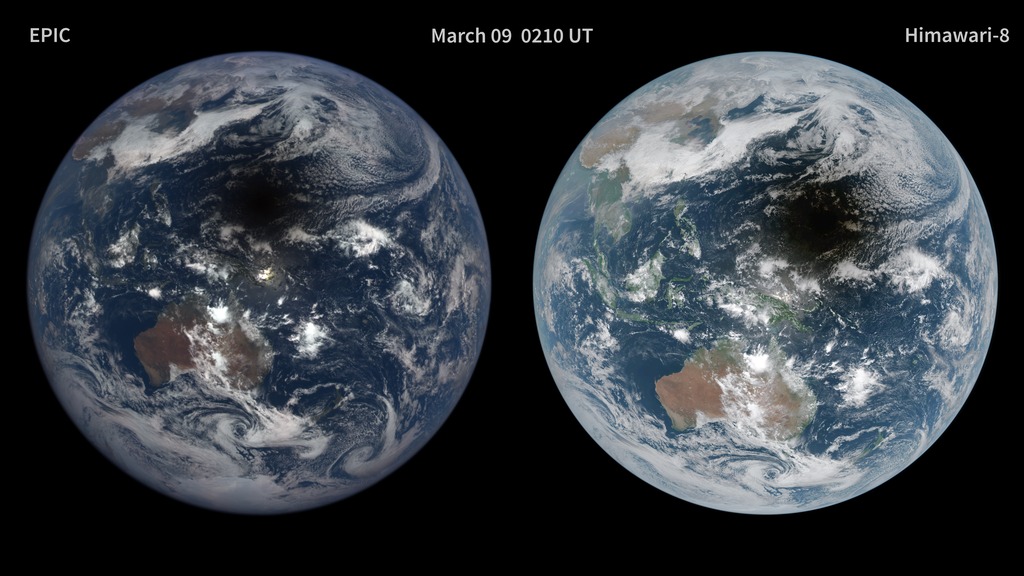
On the left, a series of images taken by NASA’s Earth Polychromatic Imaging Camera (EPIC) onboard the Deep Space Climate Observatory (DSCOVR) show the eclipse from its orbit at the first Lagrange point (L1)—a point about 1,000,000 miles (1,609,344 km) from Earth where the force of Earth's gravity almost exactly matches that of the Sun. As the DSCOVR spacecraft slowly orbits around L1 (always viewing the sunlit side of Earth) the area of reflected sunlight near the center of the globe remains stationary. During the eclipse, the moon’s shadow crosses the face of the Earth’s surface as Earth appears to rotate from left (west) to right (east) below.
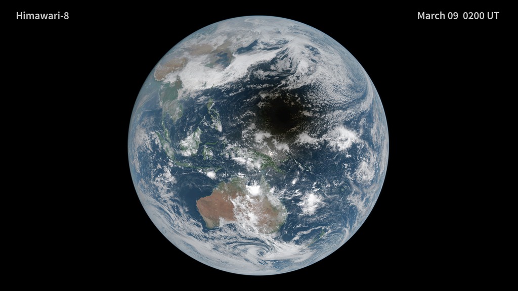
In contrast, Himawari-8, a Japanese weather spacecraft, is in geostationary orbit at an altitude of ~35,791 km (22,239 mi). This means that Himawari-8 is positioned over a particular spot on Earth—located at 141 degrees East, 0 degrees North. During the eclipse, the moon's shadow appears mid-ocean and races off to the east (right), while the area of reflected sunlight appears to move right (east) to left (west) across the Earth’s surface. The instruments onboard Himawari-8 and DSCOVR use different spectral bands so the colors of the two images appear different.
Used Elsewhere In
For More Information
Credits
"simplecolor" Himawari-8 images from NOAA/Japan Meteorological Agency (JMA), DSCOVR/EPIC images NASA Goddard
https://svs.gsfc.nasa.gov/30758
Data Used:
Deep Space Climate Observatory (DSCOVR)/Earth Polychromatic Imaging Camera (EPIC)
Himawari-8/Advanced Himawari Imager (AHI)
Keywords:
SVS >> HDTV
SVS >> Hyperwall
SVS >> Eclipse
NASA Science >> Earth


