December 02, 1999 - (date of web publication)
DATA FROM GODDARD'S MARS ORBITER LASER ALTIMETER (MOLA) PLAYS A KEY ROLE IN HELPING SCIENTISTS DETERMINE THE PRIMARY LANDING SITE
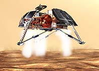
Image 1
Data from Goddard's Mars Orbiter Laser Altimeter (MOLA) played a key role in helping scientists determine the primary landing site for the Mars Polar Lander. Engineers are aiming for a 200 kilometers (125 miles) long and 20 kilometers (12-1/2 miles) wide strip of gentle, rolling plains. Launched on January 3, 1999, Mars Polar Lander will study the soil and look for ice beneath the surface of the Martian south pole.
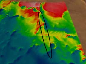
Image 2
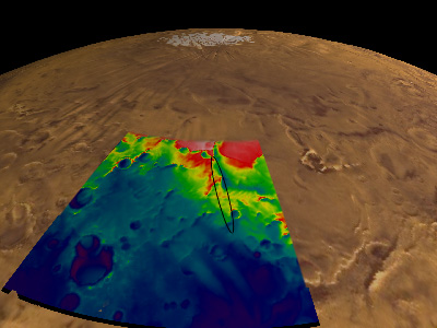
Image 3
Scientists used data from MOLA to learn about elevation changes within the primary landing site (marked with an oval.) Colors in the above right image correspond to changes in elevation. White colors indicate elevations in excess of 3012 meters, red shows elevations between 2500m - 3012m, yellow shows elevations 2450m - 2500m, dark cyan shows elevations 2150m-2450m, dark violet shows elevations from 320m - 2150m. The topography in these images is vertically exaggerated by a factor of 5.