Planets and Moons
ID: 4989
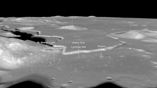
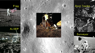
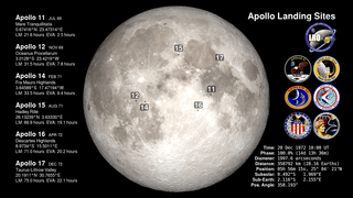
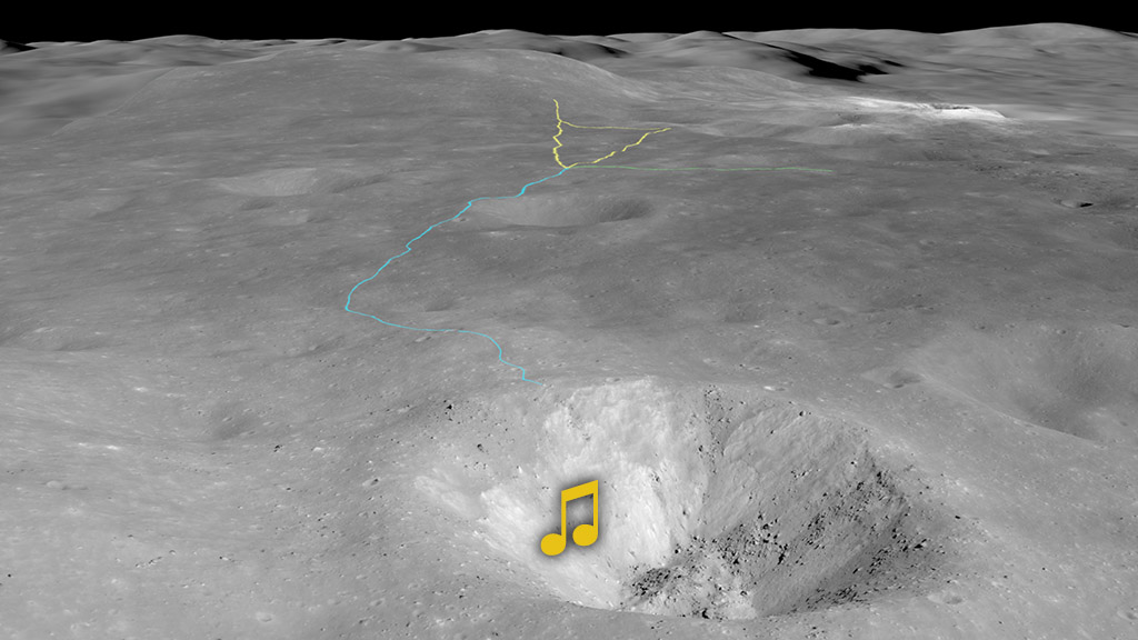
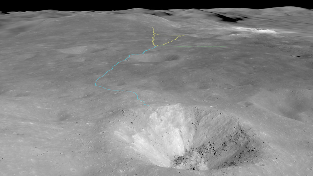
Apollo 16 landed on the Moon at 8:23 p.m. Houston time on April 20, 1972 (April 21 at 2:23 UTC). Their site north of Descartes crater was the only Apollo site in purely highlands terrain, where the surface is older, lighter in color, and more heavily cratered, in contrast to the darker basalts of the maria. Commander John Young and Lunar Module Pilot Charlie Duke explored the surface in their lunar rover, traveling a total of 16.7 miles (26.9 km) and collecting 211 pounds (95.7 kg) of samples, while Command Module Pilot Thomas K. Mattingly performed experiments from orbit.
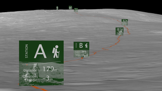
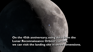
For the 50th anniversary of the Apollo 16 mission, the video presented here uses elevation maps and images from Lunar Reconnaissance Orbiter (LRO) to visualize the area around the landing site and the routes taken by the astronauts over three days of extravehicular activities (EVAs). The video begins with the camera flying west over the terrain the astronauts saw as they came in for a landing, and it ends with a dramatic view of North Ray crater, the destination of their EVA on Day 3.
Apollo 16 Lands in the Lunar Highlands
For the 50th anniversary of the Apollo 16 mission, the video presented here uses elevation maps and images from Lunar Reconnaissance Orbiter (LRO) to visualize the area around the landing site and the routes taken by the astronauts over three days of extravehicular activities (EVAs). The video begins with the camera flying west over the terrain the astronauts saw as they came in for a landing, and it ends with a dramatic view of North Ray crater, the destination of their EVA on Day 3.
Related
Visualization Credits
Ernie Wright (USRA):
Lead Visualizer
David Ladd (Advocates in Manpower Management, Inc.):
Lead Producer
Lead Video Editor
Noah Petro (NASA/GSFC):
Lead Scientist
Laurence Schuler (ADNET Systems, Inc.):
Technical Support
Ian Jones (ADNET Systems, Inc.):
Technical Support
Lead Visualizer
David Ladd (Advocates in Manpower Management, Inc.):
Lead Producer
Lead Video Editor
Noah Petro (NASA/GSFC):
Lead Scientist
Laurence Schuler (ADNET Systems, Inc.):
Technical Support
Ian Jones (ADNET Systems, Inc.):
Technical Support
Please give credit for this item to:
NASA's Scientific Visualization Studio
NASA's Scientific Visualization Studio
Short URL to share this page:
https://svs.gsfc.nasa.gov/4989
Mission:
LRO (Lunar Reconnaissance Orbiter)
Data Used:
Note: While we identify the data sets used in these visualizations, we do not store any further details nor the data sets themselves on our site.
This item is part of this series:
The Moon
Keywords:
SVS >> HDTV
SVS >> Landing Site
SVS >> Lunar
SVS >> Moon
SVS >> Hyperwall
SVS >> LRO
SVS >> Lunar Reconnaissance Orbiter
SVS >> LROC
SVS >> Apollo Missions
SVS >> Lunar Surface
SVS >> Lunar Topography
SVS >> Lunar Elevation Map
NASA Science >> Planets and Moons
https://svs.gsfc.nasa.gov/4989
Mission:
LRO (Lunar Reconnaissance Orbiter)
Data Used:
LRO/LROC/Narrow Angle Camera also referred to as: NAC
LRO/LROC NAC/Stereo DEM
ModelLRO/Wide Angle Camera also referred to as: LROC WAC
Observed DataLRO/SELENE/LOLA/TC/DIgital Elevation Model also referred to as: SLDEM2015
Model
A digital elevation model of the Moon derived from the Lunar Orbiter Laser Altimeter and the SELENE Terrain Camera. See the description in Icarus. The data is here.
This item is part of this series:
The Moon
Keywords:
SVS >> HDTV
SVS >> Landing Site
SVS >> Lunar
SVS >> Moon
SVS >> Hyperwall
SVS >> LRO
SVS >> Lunar Reconnaissance Orbiter
SVS >> LROC
SVS >> Apollo Missions
SVS >> Lunar Surface
SVS >> Lunar Topography
SVS >> Lunar Elevation Map
NASA Science >> Planets and Moons


